
Lake County is defined by three primary watersheds: (1) the Cache Creek Watershed, which contains the outflow of Clear Lake; (2) the Putah Creek Watershed, which is located directly south of Cache Creek and spans south past the county border with Napa; and (3) the Eel River Watershed in the northern part of the county. The Cache and Putah Creek watersheds drain eastward to the Yolo Bypass, and the upper mainstem Eel River Watershed flows westward to the Pacific Ocean. These watersheds support a wide range of ecosystems across Lake County, and Clear Lake sits at the center of it all, providing habitat to the endemic Clear Lake hitch and other wildlife species.
LCRCD has led watershed assessment efforts and restoration projects in Lake County since the mid-1990s. As the longest-running program area of LCRCD, its programming is upheld by numerous enduring partnerships that have been established to address watershed-wide ecosystem health and function. In collaboration with these partners across the county, the Watershed Restoration Program continues to lead riparian and wetland restoration, invasive species management, and environmental mitigation projects to improve water quality and habitat in Clear Lake and its tributaries.
Clearlake Oaks Revitalization Initiative
We are leading a team of technical experts and local organizations working to restore Schindler Creek and rehabilitate the Clear Lake Keys between now and 2036.
Kuhlanapo Wetland and Hitch Habitat Reconnection Project
The Kuhlanapo Wetland and Hitch Habitat Reconnection Project, funded by the Wildlife Conservation Board (WCB) via the California Association of Conservation Districts (CARCD), includes breaching an obsolete levee, restoring 32 acres of historic wetland at the Lake County Land Trust’s Kuhlanapo Wetland Preserve in Lakeport, and reestablishing hydrologic connection to 120 acres of functional floodplain habitat. Additional project activities include road grading, removing legacy infrastructure and invasive species, native vegetation planting, and stabilizing an access road, all of which will contribute to habitat protection as well as increased public access.
Restoring Kuhlanapo will provide critical habitat for the culturally significant and state-threatened Clear Lake hitch in addition to more than 13 other special-status species. Upon completion, the project will improve spawning and rearing conditions for Clear Lake hitch, enhance water quality and floodwater retention, and support long-term ecological resilience in Clear Lake and the surrounding watershed. This project is made possible by a team of collaborators, including LACO Associates, Lake County Land Trust, Big Valley Band of Pomo Indians, and FlowWest.
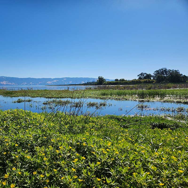
Kuhlanapo Wetland Preserve.
Photo credit: Lake County Land Trust

Interested in learning more?
Contact Dalynn Dykstra, Watershed Restoration Program Manager
Scotts Creek Watershed Restoration
[COMPLETED] Eightmile Valley Sediment Reduction and Habitat Enhancement Project
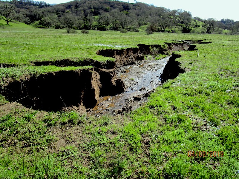
The Eightmile Valley Sediment Reduction and Habitat Enhancement Project focused on the Upper Scotts Creek watershed within the Bureau of Land Management’s South Cow Mountain Off-Highway Vehicle Recreation Area, approximately nine miles west of Lakeport. The 16-acre valley is presently characterized by grasslands and riparian habitat. When its wetlands were converted to agriculture in the early 1900s, stream degradation and other impacts followed, mobilizing significant volumes of sediment for transport into Clear Lake.
In 2012, the Scotts Valley Band of Pomo Indians, Bureau of Land Management, and West Lake Resource Conservation District (now LCRCD) came together, developed a restoration design plan, and secured implementation funding from the California State Water Resources Control Board. The project was designed to reduce sediment transport into Clear Lake, stabilize and restore channel geomorphology, and restore habitat value to the degraded meadow and riparian ecosystem. This was largely accomplished through realignment and stabilization of existing stream channels, stream bank stabilization with bio-control plantings, revegetation, and erosion control management practices.
Final Report
Eightmile Valley Sediment Reduction and Habitat Enhancement Project
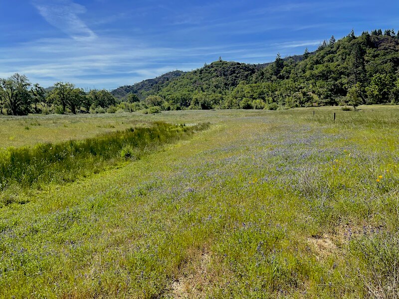
Photo credit: Lake County Resource Conservation District
Interested in learning more?
Contact Dalynn Dykstra, Watershed Restoration Program Manager
Invasive Species Management
Goat’s rue is a prolific, deep-rooting perennial legume first found in Lake County in 2022. Introduced in the late 1800s in Utah as a potential forage crop, its aggressive, long-lasting reproductive strategies and toxicity to livestock has earned the plant a U.S. Department of Agriculture (USDA) federal listing as a noxious weed. In California, the plant is listed by the California Department of Food and Agriculture (CDFA) as an “A-rated” weed. This means that the plant has been identified to have the potential to cause environmental and economic harm but still has a limited range, and rapid removal is recommended wherever possible. This A-rated listing provides a chance for managers and organizations such as LCRCD to conduct important eradication work that prevents a plant from becoming invasive.
Goat’s rue eradication efforts began in 2016 in Eightmile Valley, located inside the South Cow Mountain Recreation Area. Plant control efforts are ongoing and conducted in collaboration with the Ukiah Field Office of the Bureau of Land Management (BLM) and Lake County Department of Agriculture. Continued goat’s rue removal in this area will prevent its range from expanding beyond the South Cow Mountain area, protecting native plant communities and agricultural operations in both Lake and Mendocino counties.

Post-treatment project area in Eightmile Valley.
Photo credit: Larry Ray
Interested in learning more?
Contact Dalynn Dykstra, Watershed Restoration Program Manager
Environmental Mitigation
Middletown Phase II
Coming off of the success of the first phase of the project, LCRCD is partnering with Caltrans again to establish 12 more acres of oak woodland at Middletown Trailside Park. This second phase began in the fall of 2024 with the goal of planting and maintaining 1,000 more valley oak and blue oak seedlings. As with Phase I, a drip-line irrigation system was designed and installed to water each individual seedling, and ongoing maintenance will be performed for the next five years to ensure project success.
[COMPLETED] Middletown Phase I
In 2019, LCRCD partnered with the California Department of Transportation (Caltrans) to plant 2,000 oak trees as a mitigation measure for trees removed during the expansion of Highway 29 and as part of reforestation efforts following the Valley Fire. This restoration project became known as Phase I of the Middletown Park Project, which involved propagating, planting, and maintaining 1,600 valley oak and 400 blue oak seedlings on 6.5 acres in Middletown Trailside Park between September 2019 and June 2025. Sites were prepared, trees were planted and mulched, and an irrigation system was designed and installed during the first year of the project. Seedling maintenance activities such as supplemental watering and weed control were performed for the duration of the project, and seedlings were replaced as necessary to ensure 75% survival and future canopy development. LCRCD completed Phase I of this project in June of 2025.
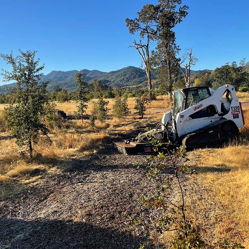
Oak planting site preparation at Middletown Trailside Park.
Photo credit: Larry Ray
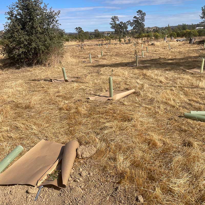
Oak planting layout planning at Middletown Trailside Park.
Photo credit: Larry Ray
Interested in learning more?
Contact Dalynn Dykstra, Watershed Restoration Program Manager